Geology Of The Project Area
The Irfon drainage basin is entirely Ordovician and Silurian, which together form the greater part of mid Wales. These rocks are variable in character, ranging from conglomerates and coarse sandstones to fine mudstones. They also vary considerably in hardness, from quartz-sandstones, and slates to soft clays. The basin can be divided into three broad geological bands with boundaries that have a north-east to south-west trend. To the north-west is 'Elenydd' (Cambrian Mountains area), to the south-east are the northern slopes of Mynydd Eppynt and between the two is the broad band of low hills stretching from Llanwrtyd in the west, to Newbridge-on-Wye and Builth Wells in the east.
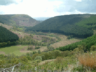
The Cambrian Mountains area consists predominately of hard, mineral poor slates capped with peat deposits. This area has a very low buffering capacity and is prone to acidification. Those rocks between Llanwrtyd and Newbridge include volcanic ashes and lavas to the west but are mostly made up of large deposits of conglomerates and coarse sandstones. North-west of the line are Silurian slates, conglomerates and sandstones. All these rocks are highly folded and faulted. The Irfon and its tributaries in this area are thus cut deeply into narrow valleys, with numerous waterfalls and gorges. Occasional areas of glacial-till and valley floor alluviums occur.
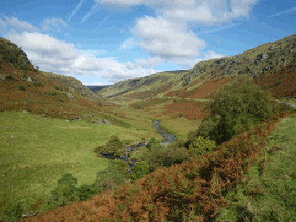
The upper Irfon valley, just upstream of Abergwesyn and the Upper Cammarch Valley.
The lowland area also consists of Ordovician and Silurian rocks, and can be subdivided into three. In the west is a triangle of pyritic mudstones, followed by bands of siltstones and fine sandstones, which define the low hills between Beulah, Llanwrtyd and Garth. The triangle between Garth, Bwlch-y-ciliau and Newbridge-on-Wye is composed of silty mudstones and occasional areas of sandstones and conglomerates.
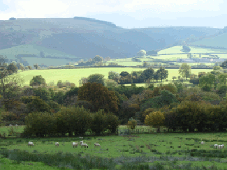
The third area, between Garth, Newbridge-on-Wye and Builth, is composed mostly of mudstones and flaggy siltstones. The rocks of this area are folded into a small number of large, open folds with vertical south-eastern limbs and very gently dipping northern ones. The Irfon and its tributaries in this area flow in shallow, open courses, frequently on rock pavements but there are also large areas of glacial-till deposits exposed in the river courses.
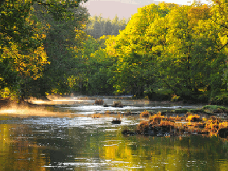
The Irfon Valley and river in its middle/lower reaches.
All the slopes of Mynydd Eppynt consist of steeply dipping, vertical or overturned flaggy siltstones. The Irfon tributaries in the steeper zone of the flanks of Eppynt frequently flow on exposed rock but in the lower zone, the streams more frequently flow on glacial till.
The soils in the Irfon catchment range from highly acidic to moderately nutrient rich and drainage varies considerably. Some of the valleys contain peat deposits. The Afon Cledan drains an extensive area of lowland peat bog.