Navigation on the Upper Wye and Usk
River Wye:
From Hay-on-Wye downstream, there has been a public right
of navigation following an act of parliament in the late 17th century.
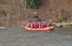
Today the majority of the users here are paddlers - canoes, kayaks,
rafts but also there is a fleet of commercial pleasure boats at Symonds
Yat. Historically, the river was used to pull goods to and from Hereford
using a purpose built "Llandoger
Trow" -
a flat bottomed boat with a very shallow draft drawn by horsepower.
However, upstream of Hay remained inaccessible to this waterborne
commerce as its steep gradient and waterfalls were an absolute barrier
to upstream traffic.
River Usk:
Draining less than one quarter of the catchment size of the Wye, the Usk is a much smaller river and it is only in the lowest section that there is a history of navigation. The difficulties in navigating upriver were overcome with the construction of the Brecon and Monmouth canal linking Brecon and Newport. There is no public right of navigation, save for a small section above Brecon.
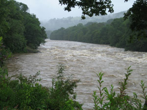
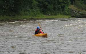
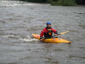
On both rivers the upper reaches have a characteristically fast "rocky" flow due to the steep gradient. These sections remained a considerable challenge to early paddlers and their wood and canvas craft.... until the development of rugged and manoeuvrable plastic canoes, kayaks and inflatable rafts. However, technological advances bring downsides as well as benefits and the wherewithal to paddle white waters has led to conflicts with anglers, owners and those who consider canoeing incompatible with wildlife and the wildness and solitude of these places.
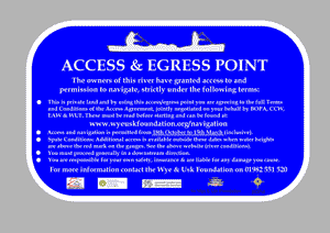
The Foundation takes the view that there is a way in which a substantial majority of the needs of all parties can be met with an organised, shared access approach. The consensus of paddlers is that higher flows are the best conditions to enjoy these reaches and these conditions prevail from late autumn to early spring. Accordingly, owners have granted access during this period and also during spate (high water) events throughout the rest of the year. (Please note that some sections can only be paddled when the river is above a certain height, whatever the time of year)
Again technology has come to our aid and webcams on river gauges have enabled up to the minute water heights to be made available to both fishers and paddlers. Full details of the canoeing arrangements on both rivers may be found via the menu on the left, including downloadable maps. We are building a database of accommodation providers who welcome canoeists and there is also a section for your feedback.
You will appreciate that a considerable effort has been made to secure access to and over these reaches. By using this website you should be able to gain access on the majority of days when there are suitable flows. If you simply want to paddle gently, over 100 miles is available to you from Hay on Wye downstream. Please follow the conditions detailed overall and those specific to each section and remember that there is a majority of river users who do not wish to be included in any confrontation and simply want to enjoy the wonderful opportunities afforded by both rivers.
Using the River Info page:
You will find information on current and predicted weather using Metcheck
and Metoffice
Spate clauses:
During the period when paddling is not permitted, high water events can trigger canoeing provided a certain river height is exceeded. This level is marked as a red line on gauges viewable through our webcams. For the links to the relevant gauge, please see the Wye and Usk introduction pages in this section (left hand menu). You may want to set up your mobile to access these images.
Thanks are due:
The arrangements detailed here were made by a steering group comprised of local riparian owners and local canoeing and outdoor centres, the British Outdoor Professionals Association who give their time freely; Powys County Council
Environment Agency Wales, Wales Assembly Government, Countryside Council for Wales and SPLASH, and the Wye and Usk Foundation have, in addition, contributed finance to the setting up of the scheme.
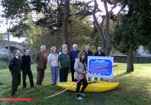
Access across land and over river has been freely granted by landowners and we are extremely grateful to them and everyone who has helped with the project.
![]()

![]()